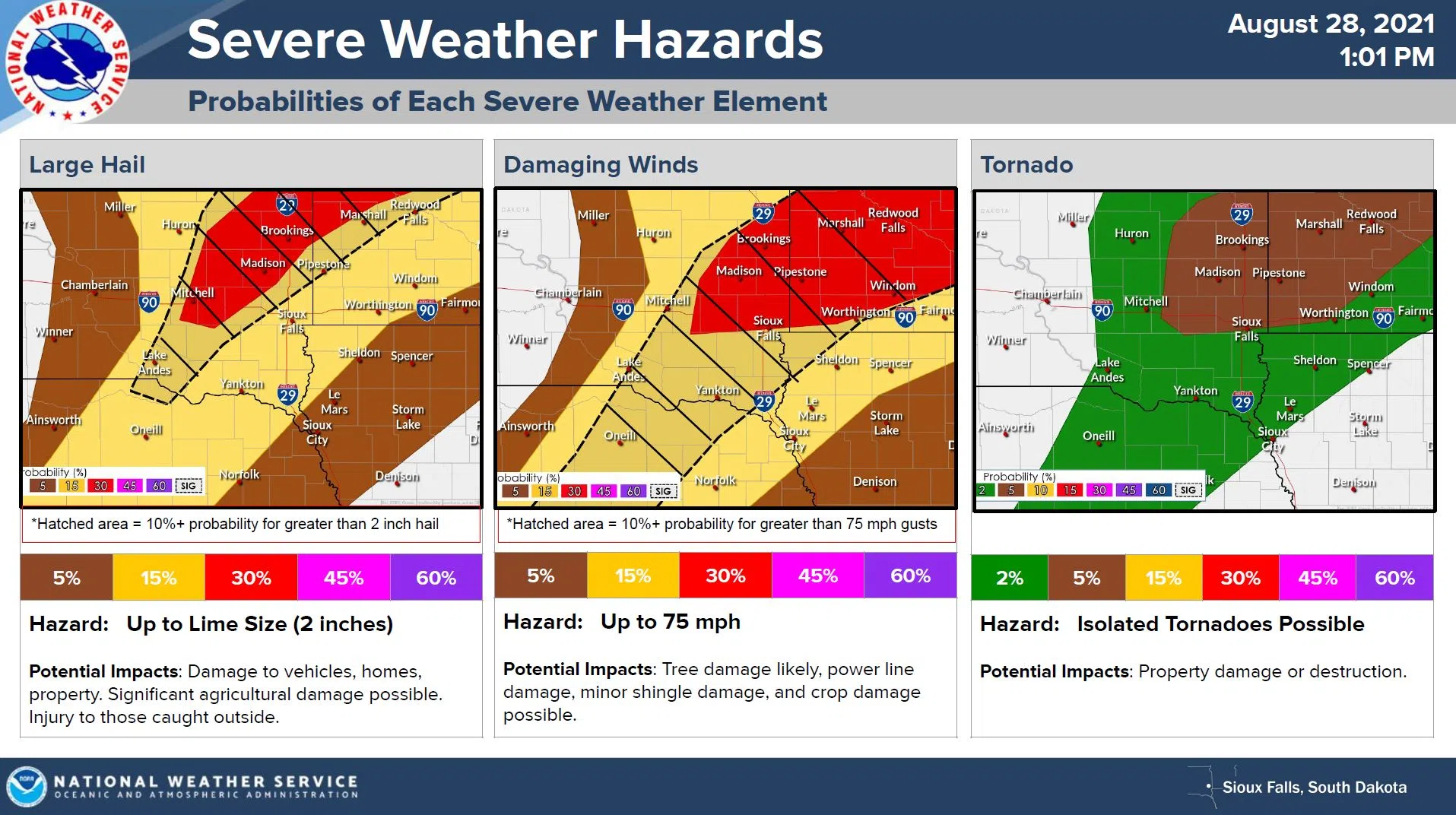
SIOUX FALLS, S.D. (KELO.com) — Scattered showers and thunderstorms will form along a cold front today. Those thunderstorms could become severe as they travel east. The Sioux Falls National Weather Service says primary hazards include lime size hail, wind gusts up to 75mph, heavy rainfall, dangerous lightning, and an isolated tornado or two.
Storms will start off isolated, with greatest risk for large hail, then are expected to consolidate into a line. The line could produce a strong wind threat.
Remain weather aware this afternoon and have a way to receive warnings.